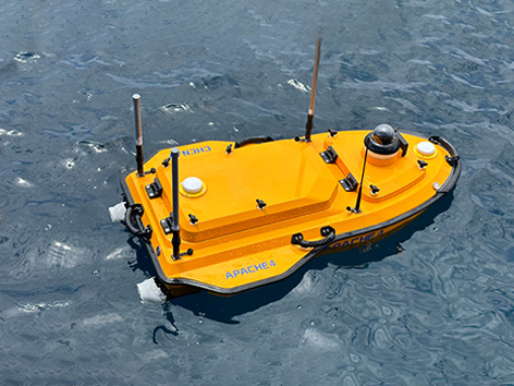
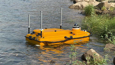
Hydrographic and Bathymetric Surveys USV
Highlights
The APACHE 4 USV is optimized for hydrological studies, supporting a range of ADCP and compact multi-beam systems. Its shallow draft, high accuracy, and stable hovering make it ideal for measuring water flow velocity and discharge. Compact and easy to handle, it ensures effortless site management, safe launches, and convenient car transport. With integrated GNSS+IMU technology, it provides reliable positioning and heading, enhancing ADCP and autopilot functionality for precise water flow analysis.
Main Features
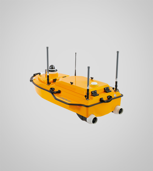
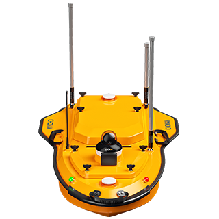
 Configurable PlatformAvailable with a selection of different sensors.
 GNSS+IMUAccurate positioning and heading data.
 Android OSAndroid software for hydrological and bathymetric surveys.
 Lightweight13 kg for single-operator deployment.
Benefits and Performances
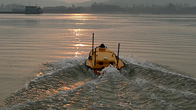
- 01Efficient Hydrographic SurveyingPerform high-quality flow and velocity measurements with stable GNSS positioning and automated navigation. Ideal for hydrologists conducting ADCP hydrographic cross-section flow measurements.
- 02Accurate Even Under Bridges
- 03Versatile Instrumentation Compatibility
- 04Integrated Single-Beam Echosounder
- 05Advanced Navigation Controller
Use Cases
 Flood Risk Assessment
 Sediment Transport Studies
 Port Current Analysis
 River Discharge Measurement
CHCNAV
APACHE 4
Detailed Specifications
Specifications
Resources
 CHCNAV APACHE 4Hydrographic and Bathymetric Surveys USVPerformances
- Speed max. : 6.5 m/s max
- Payload capacity : Up to 40 kg
- Draft : 8.6 cm (unladen)
- Positioning : Full GNSS + IMU
- Type : Single beam, 200 kHz
- Range : 0.1 to 200 m
- Accuracy : ±0.01 m + 0.1% x D
- Camera : 360° video
- Obstacle avoidance : Yes
- Precision : 0,8 cm H / 1,5 cm V
- Remote : 2,4 GHz, ≤ 1 km
- Cellular : 4G LTE
- Weight : 13 kg
- Size : 120 x 75 x 40 cm
- Battery life : 9.8 h @1.5 m/s
- Operating : -20°C to +50°C
- Protection rating : IP67